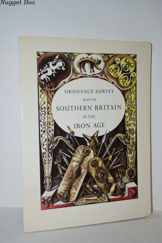
Ordnance Survey Map of Southern Britain in the Iron Age.
| Title | Ordnance Survey Map of Southern Britain in the Iron Age. |
|---|---|
| Author | , Ordnance Survey. |
| Binding | Paperback |
| Date | 1975 |
| Publisher | Director General Ordnance Survey |
| Condition | Fair |
| Our Ref # | 20723 |
| Price | £10.80 + Free delivery in the UK Included |
Description
Pale cover with light discolouration around edges otherwise general wear to the book, cover, edges and corners.
Internally Good - Quick flick through pages could not see any issues, clean and tidy copy in tight binding, A Good personal copy.
** 402g ** All orders are sent with a tracking /signature service for your peace of mind, so that you can keep tabs on your parcel.
For overseas customers - on some sites we use, parcels weighing over the standard rate may incur an additional charge and we will then contact you with the additional shipping fee required.
This is for the postage only we do not charge you for our time or our excellent packaging, which we are noted for.
Dispatched in cardboard mailers within 24/48 Hours Mon - Friday 2pm, except bank holidays, otherwise next business day - excellent service guaranteed.
.
| Price |
£10.80 |
Free delivery in the UK Included |
|---|
Other Books In This Category
The Victorian Peasant
Light wear to the book, cover, edges and corners. Internally Very Good - Quick flick through pages..
£9.00
The Red Brigade - the Official History of the New South Wales Fire Brigade
2 Gift inscriptions to ffep. Book itself is in very good condition throughout - looks unread, clea..
£10.80
Henry V As Warlord
Dust wrapper with some sun fading to parts of wrapper. Internally Very Good - clean and tidy copy ..
£9.00
Roaring Twenties
Small price label on back cover. No major issues just general wear. Internally Good. Quick flick t..
£9.00


